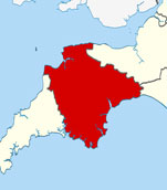
Map of Woolfardisworthy Devon and Surrounding Areas
Detailed street map of Woolfardisworthy village centre and the surrounding areas, towns & villages.
 |
||
Woolfardisworthy Map Devon Showing the Village and its Surroundings
Street Map of the Devon Village of Woolfardisworthy: Find places of interest in the village of Woolfardisworthy in Devon, England UK, with this handy printable street map. View streets in the centre of Woolfardisworthy and areas which surround Woolfardisworthy, including neighbouring villages and attractions such as Parkham, Horns Cross and Clovelly. Large Woolfardisworthy map.
Highlights of This Woolfardisworthy Devon Map:
- Easy to Print Map for Village Centre of Woolfardisworthy.
- Get a Satellite View of Woolfardisworthy.
- Find Routes To and From Woolfardisworthy area.
- View Villages and Towns Around Woolfardisworthy Devon.
- Identify Woolfardisworthy Areas of Interest.
- Find Hotels and Accommodation Near Woolfardisworthy.
- Easily Find Woolfardisworthy Tourist Attractions.
- Zoom in, Pan and Move Around Woolfardisworthy.
- Locate Local Caravan Parks and Holiday Parks.
Locate streets and roads in and near Woolfardisworthy, locate interesting places and attractions in and near Woolfardisworthy, locate towns and villages surrounding Woolfardisworthy area.
- Map of Silverton Area and Surroundings Devon
- Map of Honiton Area and Surroundings Devon
- Map of Holcombe Area and Surroundings Devon
- Map of Marldon Area and Surroundings Devon
- Map of Aylesbeare Area and Surroundings Devon
Villages and towns surrounding Woolfardisworthy in Devon include: Parkham, Horns Cross and Clovelly.
England Town Maps - Cornwall Maps - Wales Town Maps